 Laser Scan - 3D Point Cloud


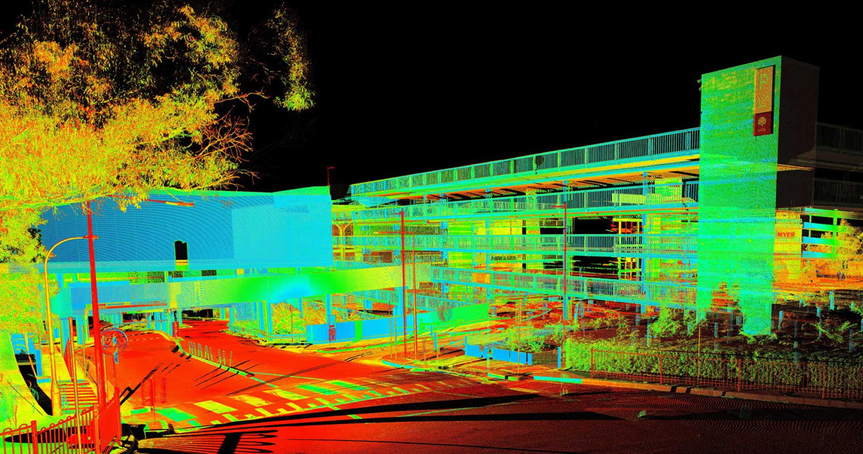


Laser Scanner - 3D Point Cloud
WHAT IS THE LASER SCANNER?
The terrestrial laser scanner is a massive data acquisition device which reports a generated three-dimensional point cloud from the measurement of distances and angles by means of a laser beam.
UNDER CONSTRUCTION
Effective planning is vital for architects, builders and contractors on any type of construction project. Having available 3D documentation at all stages, from initial design to final inspection, helps avoid costly adaptation errors.
Architectural firms, engineering companies and contractors alike have embraced laser scanners for 3D modelling and documentation of existing buildings. Their projects range from construction of houses to renovation of city centres and construction of offices.
STUDY AND PLANNING STAGE
The laser scan will be a very powerful tool to analyse possible places where the construction will be located since scanning will have a level of detail much higher than the conventional level through classical topography, helping designers get a more complete picture of the place.
DURING CONSTRUCTION
It will be possible to scan in several stages of the construction and thus verify the progress and fulfilment of all the guidelines, as well as to obtain highly valuable data for the preparation of future phases of construction. In interior construction projects, it will be possible to scan in several stages and thus be able to prepare the virtual 3D model of the place. With this 3D modelling tool, you can compare the current 3D construction status with the CAD model at any time, a quality control process that avoids errors and, therefore, time and money.
CURRENT STATUS OF CONSTRUCTIONS
With the laser scan, we will collect more information for the realisation of current construction status, making it possible to deliver both the 2D plans and the point cloud to work later for BIM.
CULTURAL HERITAGE
Ideal for quickly capturing buildings and historic sites with great precision and detail, generating 360-degree point clouds of the scanned surfaces to create 3D models to be used in building restoration or historic conservation plans.
It is a good solution for restoration or scientific analysis to provide researchers and scientists with 3D CAD models of construction plans (As-built) of buildings to determine their structural integrity.
- Topographical Plans
- Measurement Plans and Boundary Studies
- Georeferenced plans
- Laser Scan - 3D Point Cloud
- Survey Plans
- Present Building state
- Laying Out of Limits
- Laying Out of Works
- Longitudinal Levelling and Profiles
- Cadastre
- Herat Movements and Volume Calculation
- 3D Photogrammetry
- Bathymetric Plans
- Sunlight studies
- Special Works